


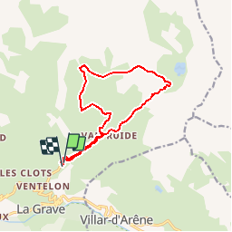
LES HIÈRES (13 KM - D. 1043 M)

Thomasdanielle
User


5h16
Difficulty : Very difficult

FREE GPS app for hiking
 SityTrail
IGN / Geographical institutes
SityTrail Plus
The world is yours!
About
Trail Walking of 12.8 km to be discovered at Provence-Alpes-Côte d'Azur, Hautes-Alpes, La Grave. This trail is proposed by Thomasdanielle.
Description
D/A : Les Hières - Hameau de Valfroide - Avant d'arriver au Lac du Goléon au point Berg tourner à gauche suivre la roche de Casse puis aller en direction du Chalet du Puy Granier, continuer jusqu'à la Saulce puis rejoindre la descente retour vers les Hières.
Positioning
Comments